
Safety and Security Mapping
Improve emergency response and coordination with clear, location-based visibility
Provide staff and first responders with clear visibility into buildings, assets, access points, and evacuation routes when it matters most
During an emergency, teams rely on accurate information to respond quickly and make informed decisions. When that information is incomplete or hard to access, it leads to delays, confusion, and gaps in communication.
Map I.T. helps organizations create and maintain clear, reliable mapping and GIS systems that provide the visibility teams need to understand environments, coordinate effectively, and respond with confidence.
What safety and security mapping makes possible
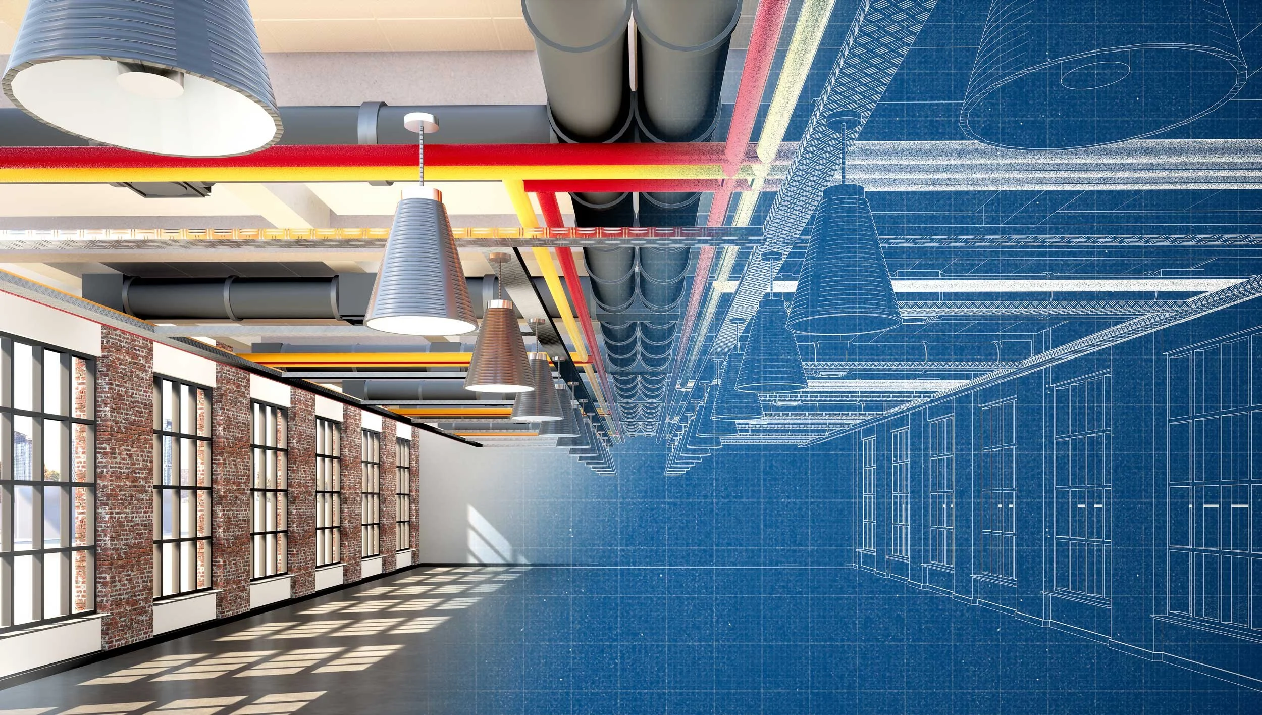
Safety and security mapping brings together building layouts, access points, evacuation routes, and critical infrastructure into one system. This includes accurate indoor maps, digital floor plans, and connected data that reflect how your facilities actually function.
Instead of relying on printed plans or static documents, teams can quickly access clear, up-to-date information about building layouts, entrances and exits, and critical safety assets.
This makes it easier to understand environments in real time, coordinate across teams, and respond more effectively during emergencies.
The result is faster response, improved communication, and better situational awareness when it matters most.

Why static maps and outdated plans fall short
Many organizations rely on printed floor plans or static documents for safety planning. Over time, these become outdated and difficult to maintain.
When information isn’t current or easily accessible, it slows response times, creates confusion, and makes coordination more difficult during critical situations.
A connected mapping system ensures that information stays accurate, accessible, and usable across teams and agencies.
Supporting preparedness, coordination, and response
-
![]()
Emergency Response Coordination
Provide first responders with accurate building layouts, access points, and critical information before and during an incident. Mapping helps teams understand unfamiliar environments and coordinate more effectively.
-
![]()
Safety Planning & Preparedness
Support safety planning with reliable building data, evacuation routes, and asset visibility. Mapping makes plans easier to build, update, and execute in real-world situations.
-
![]()
Asset Visibility
Identify and visualize critical safety assets such as AEDs, fire extinguishers, cameras, and utility shutoffs. Teams can quickly locate what they need without searching or relying on memory.
-
![]()
Evacuation Planning & Route Optimization
Plan and evaluate evacuation routes using accurate building layouts, street, and other community data. Mapping helps ensure routes are clear, accessible, and aligned with how people actually move through spaces.
-
![]()
Multi-Agency Coordination
Provide a shared source of information for staff, first responders, and external agencies. Consistent, location-based data improves communication and reduces confusion during emergencies.


A partner to your safety planning efforts
Map I.T. works alongside safety consultants, administrators, facilities teams, and public safety agencies to provide the accurate, usable data these plans rely on.
We don’t replace your safety planning process; we strengthen it by ensuring the information behind it is complete, current, and accessible.
What We Do
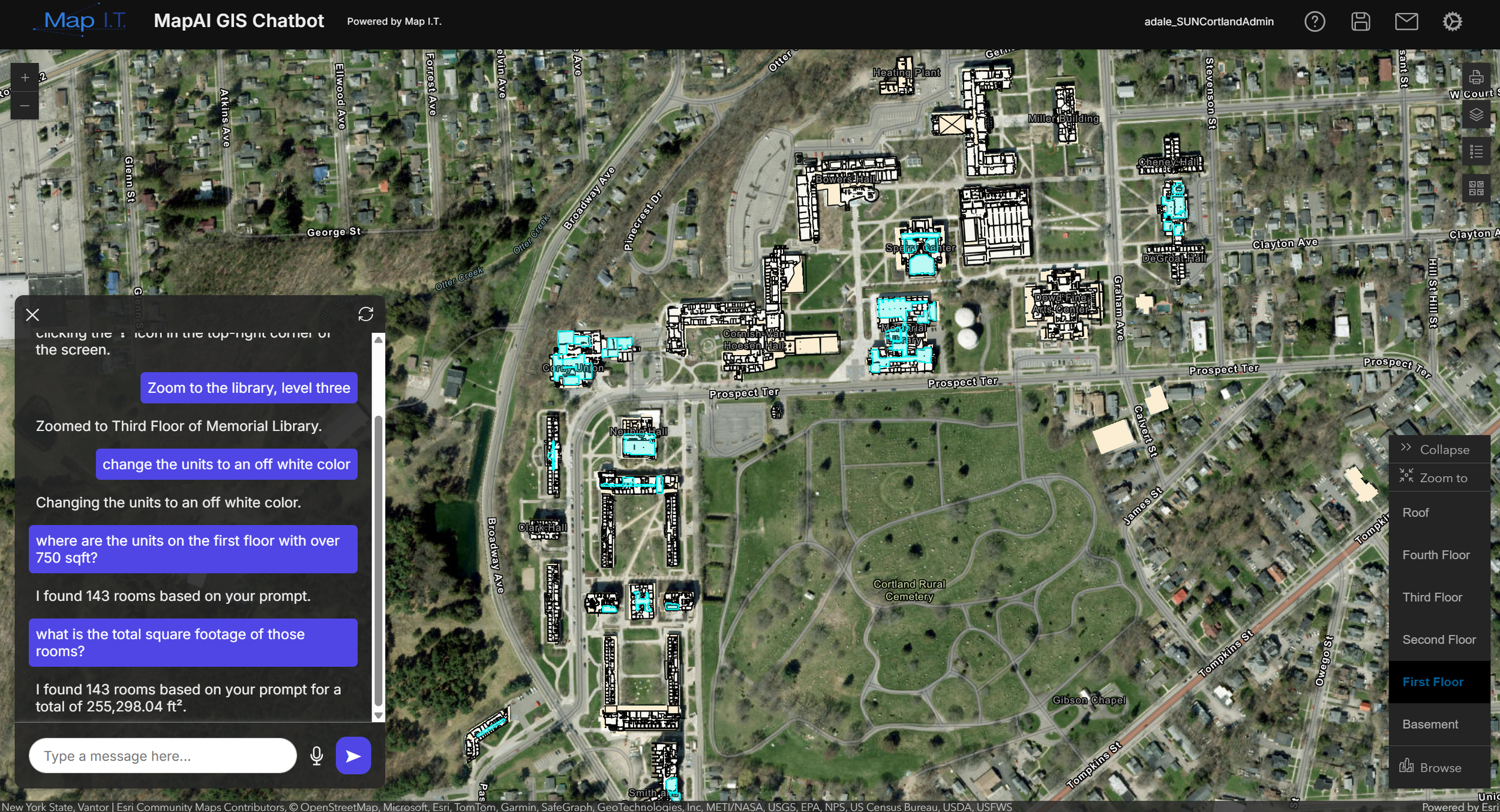
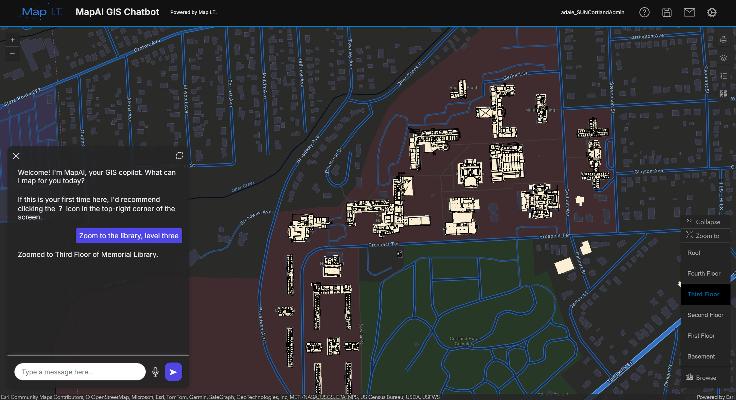
Convert floor plans (PDF, CAD, or BIM files) into an ArcGIS Indoors database
Capture existing conditions with cutting-edge 3D data capture technology (LiDAR laser scanning)
Collect 360° panoramic imagery for visual context and remote situational awareness
Create accurate and reliable floor plans with critical infrastructure identified
Seamlessly navigate complex, multi-level facilities with accurate indoor maps and digital floor plans
Integrate indoor data with existing campus or public safety GIS systems and third-party applications
Configure web and mobile maps for real-time access by security teams and first responders
Provide training and documentation to ensure staff can confidently use and maintain the system

Experience supporting school safety and campus preparedness
Map I.T. has experience working with K–12 school districts and higher education campuses to support safety planning, emergency preparedness, and campus coordination through accurate mapping and GIS systems.
We understand the unique challenges schools face, including working with multiple buildings, coordinating across teams, and ensuring information is accessible to both staff and first responders.
Our work supports schools and campuses in building reliable systems that improve preparedness, strengthen communication, and help teams respond with confidence.