
Education & Campus Environments
Improve school safety, coordination, and campus planning with accurate, visible data
Map I.T. supports K–12 school districts and higher education campuses with mapping and data systems that help teams plan, respond, and operate with confidence
Schools rely on accurate information to manage facilities, support safety planning, and coordinate across teams. When that information is incomplete or hard to access, it slows decisions and creates gaps during critical moments.
Map I.T. helps schools build clear, reliable systems that connect buildings, assets, and data into something teams can actually use.
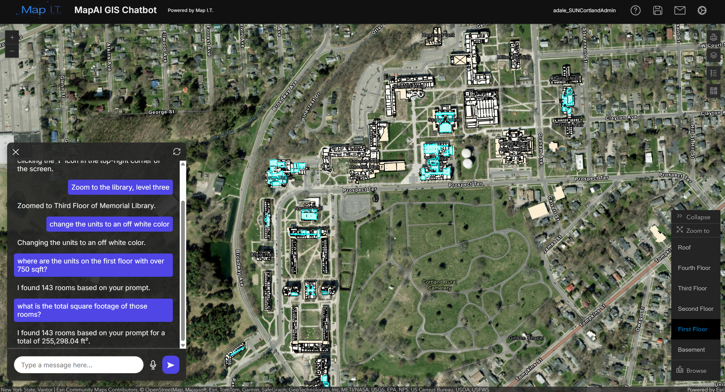
What indoor mapping and GIS mean for schools
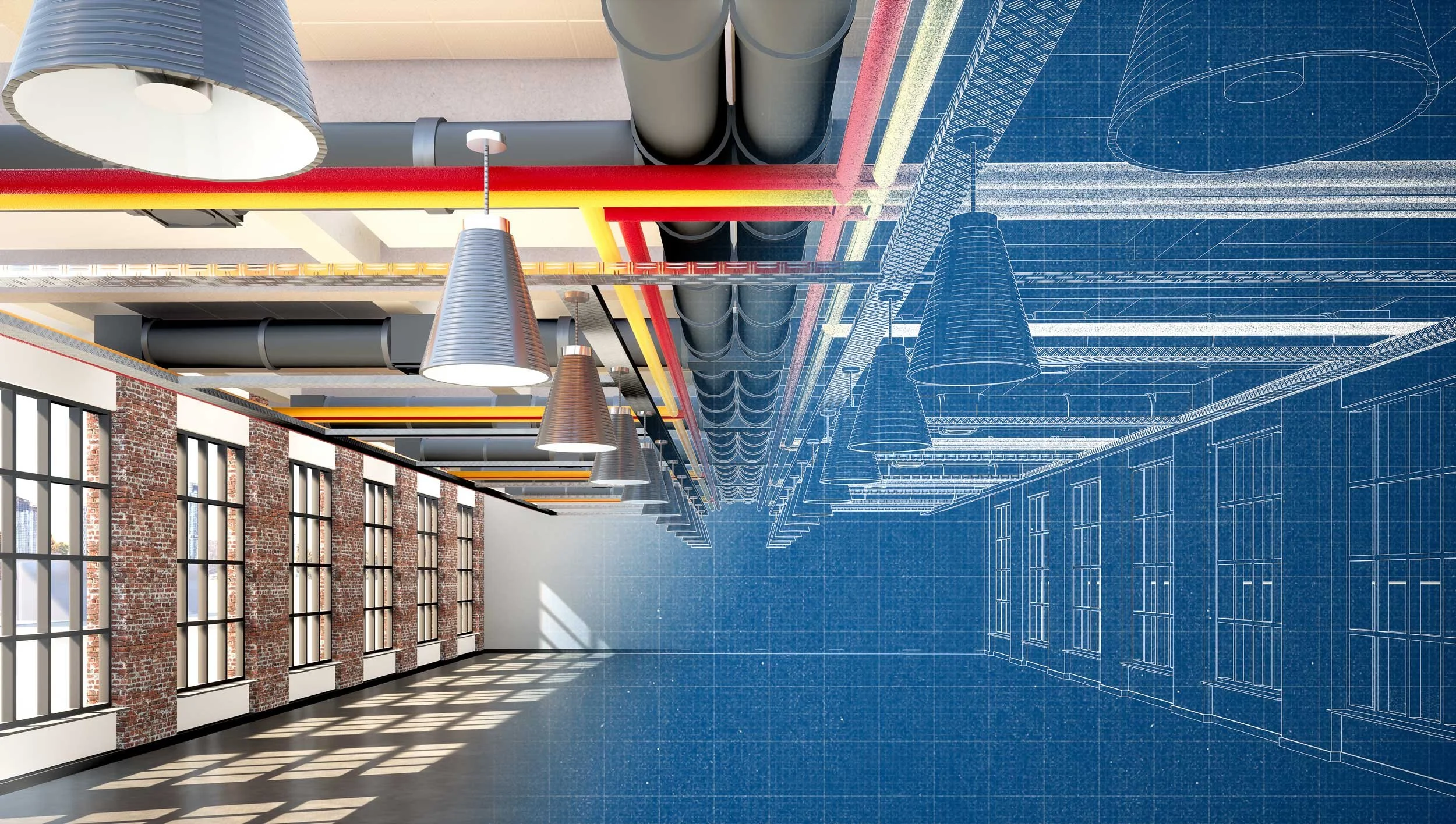
Mapping and GIS bring together information about your buildings, assets, infrastructure, and operations into one system. This includes accurate digital floor plans, campus maps, and connected data that reflect how your environment actually functions.
Instead of relying on disconnected files or outdated drawings, schools can access and use information across teams to support day-to-day operations and long-term planning.
This can include understanding where assets are located, planning maintenance and facility upgrades, analyzing enrollment and demographics, optimizing transportation routes, improving wayfinding, and supporting safety and emergency response.
The result is information that is easier to maintain, easier to access, and more useful across your organization.

Supporting safety, operations, planning, and decision-making across your organization
School Safety & Emergency Preparedness
Support safety planning with accurate building information, asset visibility, and evacuation route planning. Mapping helps staff and first responders understand your facilities before they arrive, locate critical safety assets, and coordinate more effectively during emergencies.
Map I.T. works alongside safety consultants, school leadership, and internal teams to provide the accurate, usable data those plans rely on.
-
![]()
Facilities & Maintenance
Track assets, plan maintenance, and manage buildings with reliable, up-to-date information. GIS helps facilities teams locate equipment, manage inspections, and keep data current as changes are made across campus.
-
![]()
Transportation & Routing
Plan and optimize transportation routes using accurate location data. Mapping supports bus routing, pickup and drop-off planning, and coordination across districts to improve efficiency and reduce travel time.
-
![]()
Administration & Planning
Support decision-making with better visibility into your campus and operations. GIS can be used to analyze enrollment trends, evaluate facility usage, and plan for future growth, renovations, and resource allocation.
-
![]()
Student & Visitor Experience
Improve how people navigate your campus with clear, accessible maps. Digital wayfinding experiences help students, staff, visitors, and emergency personnel find their way through buildings and across campuses more easily.
-
![]()
IT & GIS Teams
Manage and maintain a centralized system that connects data across departments. GIS provides a structured environment where information can be updated, accessed, and shared to support ongoing operations and planning.

How this works for your school or campus
Map I.T. works with your existing data, teams, and systems to build a solution that fits how your organization operates. This can include using your current floor plans and records, as well as capturing new data to fill gaps and ensure your information is complete and accurate.
What we do
Reviewing existing floor plans, CAD/BIM files, and available data
Capturing existing conditions where information is missing or outdated using scanning and field data collection
Creating accurate digital floor plans with key infrastructure, access points, and safety assets identified
Organizing building and campus data into a structured system that reflects how your facilities operate
Integrating indoor and campus data with your existing GIS and other systems
Making maps accessible through web and mobile applications for staff and first responders
Providing training and documentation so your team can confidently use and maintain the system
Ready to find out how your school can adopt indoor Mapping & GIS?

Experience supporting schools and campuses
Map I.T. has experience working with K–12 districts and higher education campuses to support safety planning, facilities management, and campus operations through accurate mapping and data systems.