
Access and Use Your Data More Easily with MapAI
Simplify GIS with AI
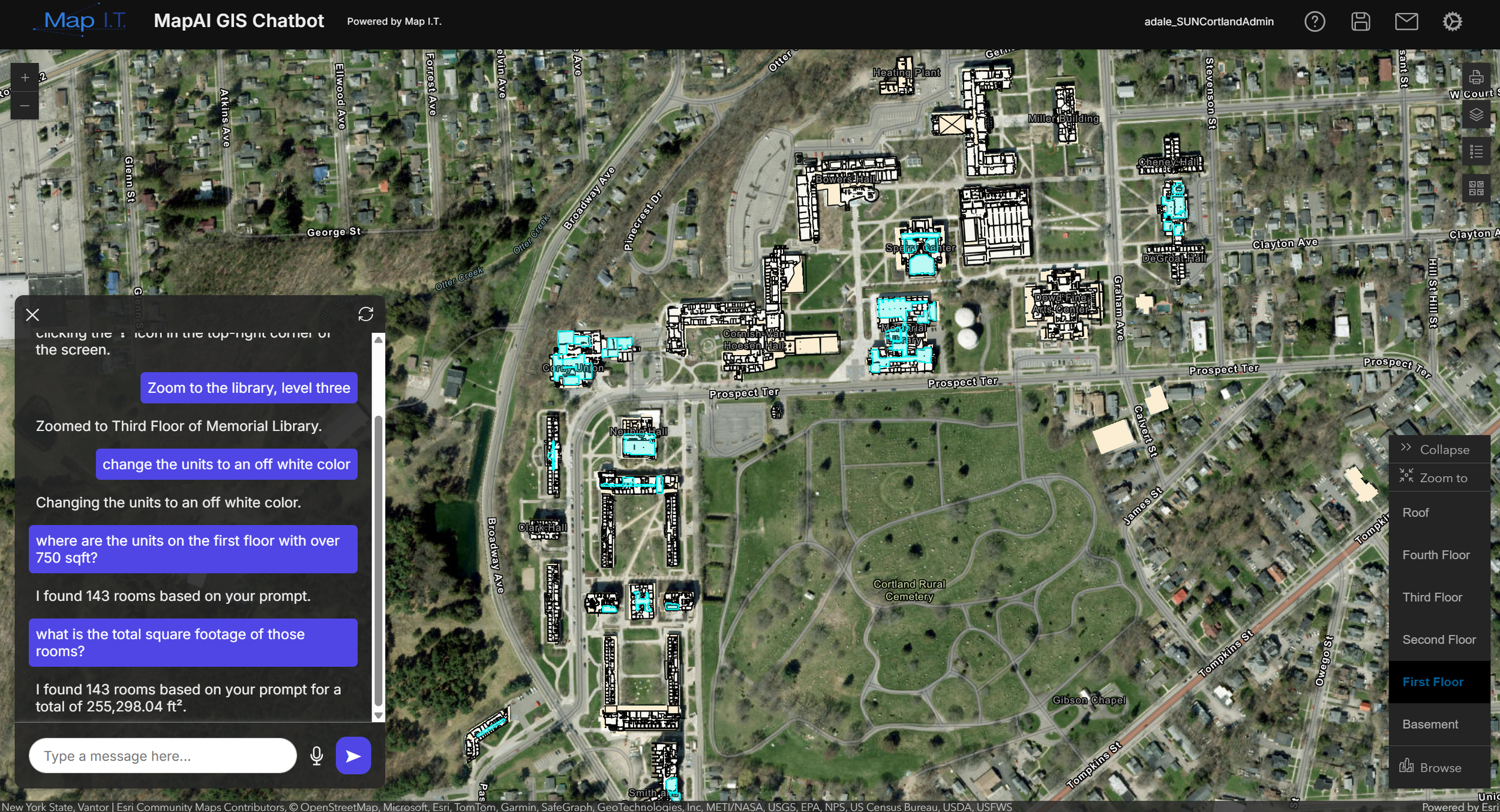
AI-powered assistance designed to simplify your GIS workflows, automate tasks, and make data more accessible across your organization
GIS systems contain valuable information, but accessing that information often requires technical knowledge and time spent navigating complex tools.
MapAI is built to simplify how users interact with GIS. It allows teams to ask questions, find information, and work with data more directly, without relying on manual workflows or directing all questions through technical teams.
MapAI provides a more direct way to interact with your data. Instead of navigating layers, tools, and queries, users can ask questions and quickly find the information they need, directly from within your ArcGIS environment.
This reduces time spent searching for data, improves efficiency, and allows more team members to work with GIS without requiring deep technical experience.
Data Collection Capabilities
-
![]()
LiDAR Scanning
Capture high-density 3D point cloud data of buildings, sites, and infrastructure. Deliverables include detailed spatial data for modeling, measurement, and analysis.
-
![]()
Mobile & SLAM Scanning
Rapidly capture indoor and complex environments using mobile scanning systems. Deliverables support mapping, documentation, and environments where traditional setups are not practical.
-
![]()
Aerial Data Collection
Capture site and corridor data using UAV-based systems. Deliverables include aerial imagery, surface models, 3D point clouds, and site context for planning and analysis.
-
![]()
GNSS Mapping
Collect high-accuracy geospatial data using GNSS equipment. Deliverables include mapped points, control data, construction staking and layout, and infrastructure locations tied to real-world coordinates.
-
![]()
360° Imagery
Capture panoramic imagery for visual context and remote access. Deliverables support documentation, inspection, and virtual navigation of environments.


Here to Support Your High Accuracy Data Needs
Accurate data collection is the foundation for mapping, modeling, and decision-making. Map I.T. provides survey-grade data acquisition services that capture detailed, reliable information about your environment in a format that supports your project and workflow.

Trusted by organizations managing complex environments

740M+
Miles Sq. Ft. Mapped
100M+
People Safeguarded
30
Years of Experience