
Museums & Historic Preservation
Capture and preserve museums, historic buildings, and sites with accurate 3D models and GIS
Use 3D scanning, complete digital twins, and location-based data to document spaces, support restoration, and improve advocacy
Most museums and historic sites have some level of documentation. The challenge is making sure that information is accurate, complete, and usable beyond a single project.
With 3D scanning and mapping, organizations can capture buildings and sites as they exist today. This creates detailed digital records and complete digital twins that bring together spatial data, structure, and relationships across a site.
These systems go beyond static models. They provide a geospatial view of a space that can evolve over time, supporting restoration, tracking changes, and maintaining an accurate record of how a site exists today.
These records can be used to support preservation, planning, and long-term stewardship. They also provide a reliable reference point if spaces are damaged or lost, making reconstruction more accurate and informed.
Beyond preservation, this information can be used to improve access and engagement. Digital models and location-based data make it easier to share spaces with the public through virtual experiences, education, and advocacy efforts.
Supporting museums and historic sites with mapping, preservation, and public engagement
-
![]()
Documentation & Existing Conditions
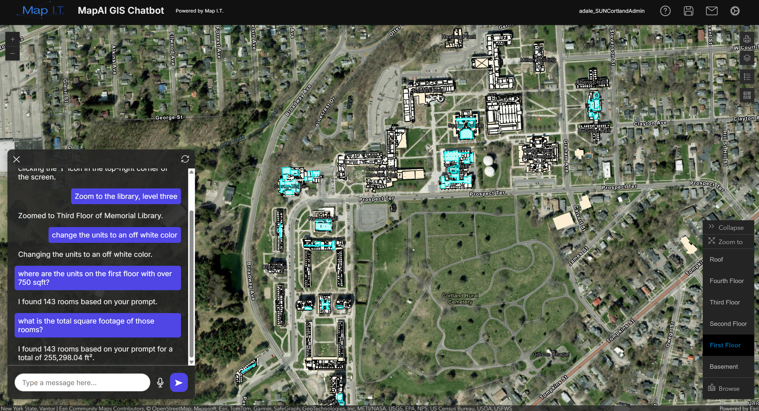
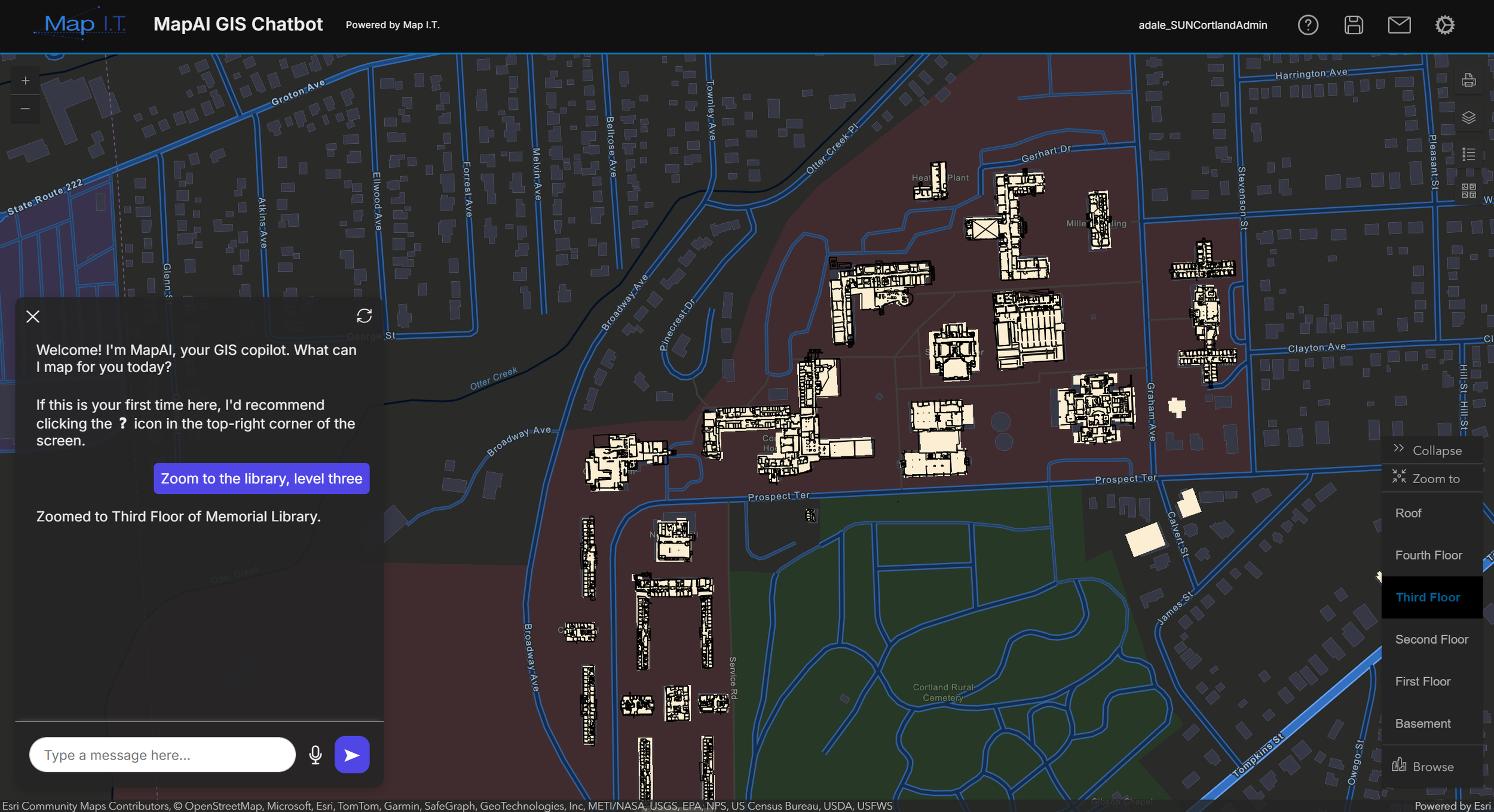
Capture accurate records of buildings and sites as they exist today. 3D scanning combined with GIS provides a reliable foundation for preservation and long-term management by documenting structure, layout, and spatial relationships across a site.
-
![]()
Preservation & Restoration Planning
Support restoration efforts with accurate, real-world data. When existing conditions are clearly documented and tied to location, teams can plan work more effectively and maintain historical integrity without relying on outdated drawings or assumptions.
-
![]()
Digital Twins & Spatial Systems
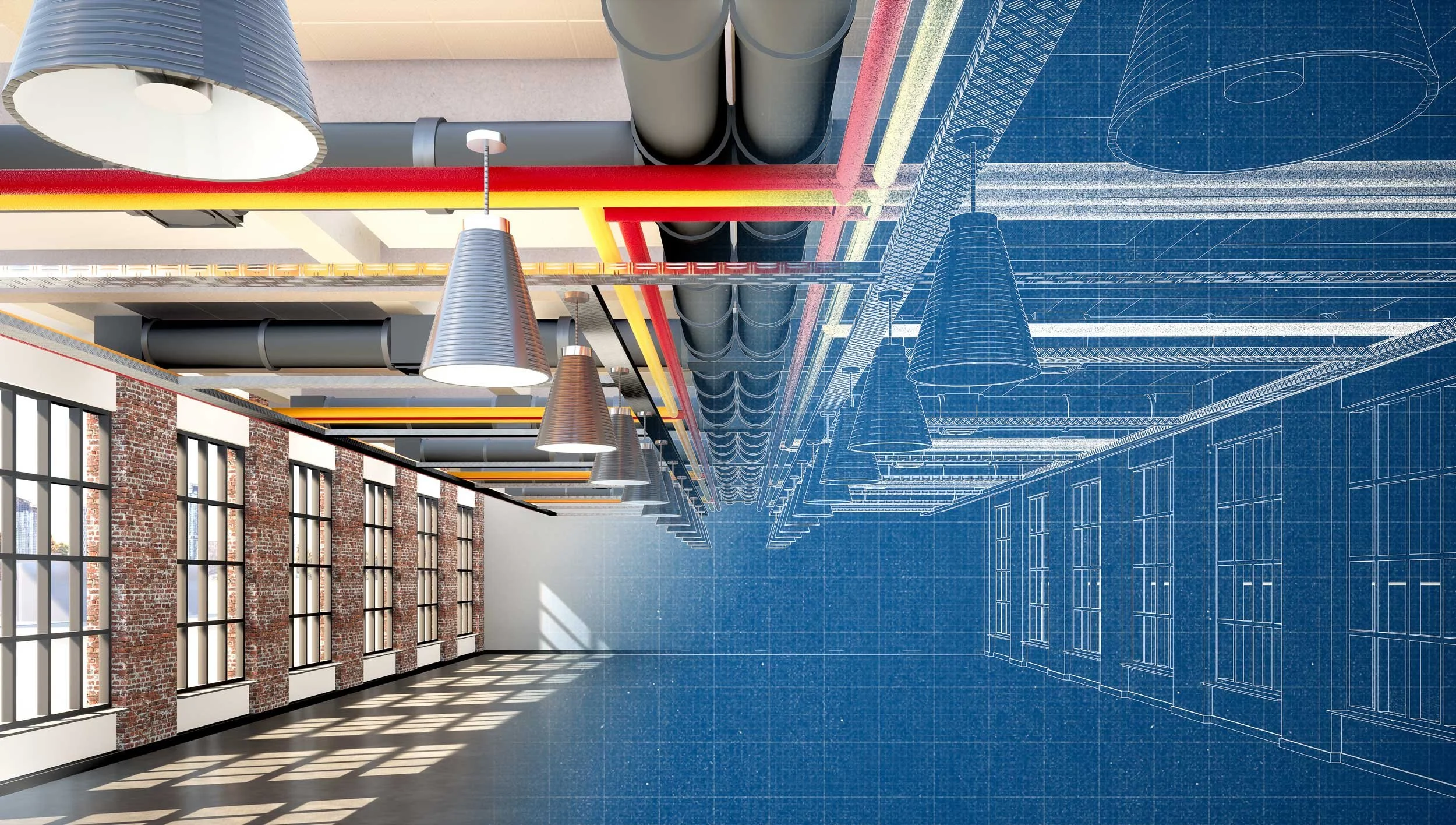
Create complete digital twins that combine 3D models with GIS data to reflect how buildings and sites exist in the real world. This connects structures, assets, and spatial context into one system that can be updated and used over time.
-
![]()
Realistic Rendering & Visualization
Use advanced capture methods, including Gaussian splats and high-fidelity 3D rendering, to create realistic visual representations of spaces. When combined with GIS, these models can be explored in context, helping teams and stakeholders better understand environments at both the building and site level.
-
![]()
Public Engagement & Advocacy
Make spaces more accessible through interactive maps, virtual tours, and location-based experiences. GIS connects visual models to real-world context, making it easier to share sites with the public, support education, and build stronger advocacy for preservation efforts.
-
![]()
Planning & Site Management
Understand how spaces are used and how they can evolve over time. GIS supports planning across buildings and sites by connecting spatial data with real-world use, helping teams plan exhibits, renovations, and future development.
-
![]()
Team & Stakeholder Coordination
Provide a shared understanding of buildings and sites across staff, leadership, and external partners. A centralized GIS-based system ensures everyone is working from the same accurate, up-to-date information.


A partner to your preservation and documentation efforts
Most museums and historic sites already have drawings, records, or past documentation efforts. The challenge is making that information consistent, accurate, and usable across projects instead of starting over each time.
Map I.T. works with your existing documentation and captures new data where needed to create a system that reflects your buildings and sites as they exist today. This allows your information to be maintained, updated, and reused over time rather than recreated for each new initiative.
What We Do
Review existing drawings, records, and available documentation
Identify gaps, inconsistencies, and areas where information may be outdated
Capture existing conditions using 3D scanning, imaging, and other field data collection technology
Create accurate digital models, floor plans, and visual records
Develop complete digital twins that connect 3D models with GIS data
Organize information into a structured system that can be used across teams
Support integration with existing tools and workflows
Provide training and documentation to support long-term use

Experience supporting museums and historic sites
Map I.T. supports museums and historic preservation efforts with 3D mapping and GIS systems that improve documentation, planning, and public engagement.