Harnessing the power of mapping and geospatial technologies through:
Data collection
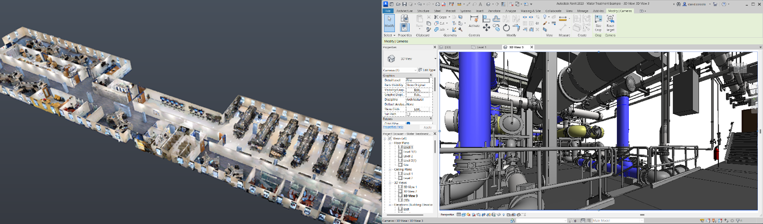
Existing condition documentation with CAD and BIM
GIS services
Indoor Mapping
Whether you require a 2D map, 3D model, or a complex automated GIS workflow, our team is equipped to create a customized solution tailored to meet your specific needs.

DATA COLLECTION
Reality capture
LiDAR Laser Scanning
GPS data collection
Traditional Surveying

SERVICES
EXISTING CONDITION DOCUMENTATION
CAD drafting
BIM modeling
GIS mapping
GIS SERVICES
GIS consulting
Digital Twin development
Asset management
Utility mapping
Augmented reality
GIS customization and automation
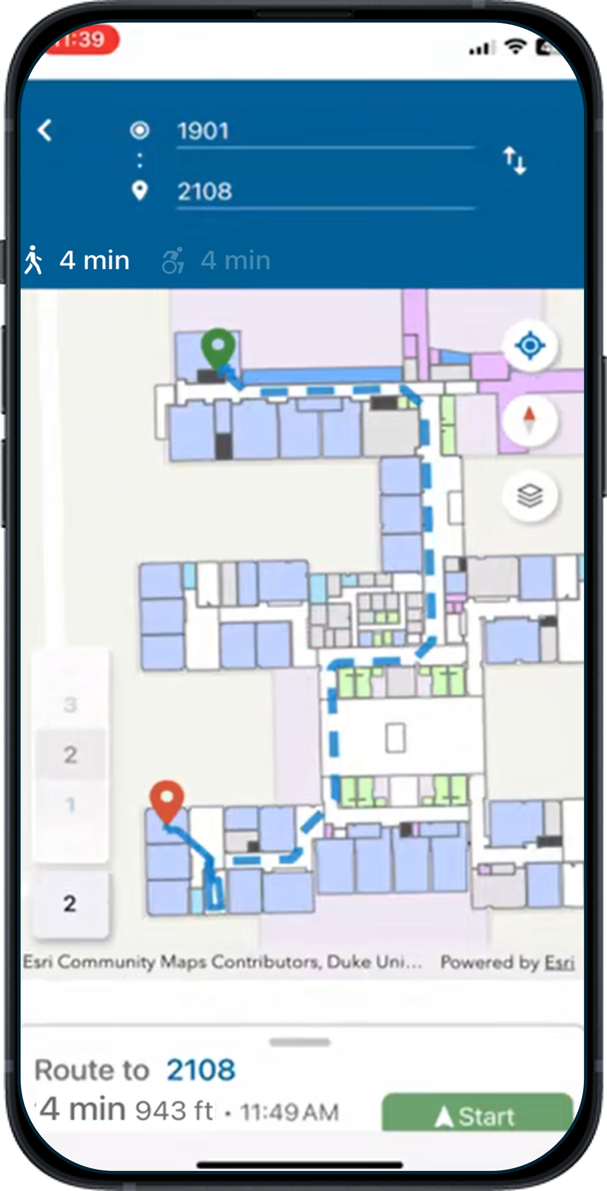
INDOOR MAPPING
ArcGIS Indoors
Facility management
Safety and security
Space planning
Wayfinding
WHO WE ARE
With a wealth of industry experience, Map I.T. possesses a comprehensive understanding of a project’s entire life cycle, spanning from initial information gathering and data collection to the development of final project deliverables, while also providing ongoing support. We are steadfast in our commitment to staying at the forefront of technological advancements to ensure that Map I.T. employs cutting-edge tools and techniques for delivering precise, detailed, and impactful custom geospatial solutions. Map I.T. excels in synthesizing various data collection techniques and software to produce powerful deliverables.
WHAT WE DO
Create maps of above and below ground existing conditions for documentation
Use a combination of advanced geospatial tools to capture data
Create easy to use, easy to share mapping deliverables through various software packages
WHY WE DO IT
To answer the “where and what” questions of a project
Improve planning, design, construction, and maintenance
Improve knowledge, communication, safety, and efficiency
Zach Jaffe, LSIT is the founder and CEO of Map I.T. and brings over a decade of experience and innovation to the world of GIS and Geospatial consulting. With a degree in geography and GIS, as well as professional training and extensive experience as a land surveyor, Zach is an expert in a wide array of data collection techniques and possesses the extensive knowledge and experience required to effectively deliver content to clients through GIS. As an early user of BIM and GIS integration, Zach established himself as a thought leader and advocate for digital twin technologies. Zach's expertise and insights have gained industry recognition, as he was invited as the Esri Infrastructure and Management 2020 AEC keynote speaker as well as a distinguished speaker and panelist for numerous GIS and industry-specific events. In 2022, Zach was honored with the Esri AEC Hero Award for his innovative work with GIS and digital twin technologies.
Learn more about Zach and his work in a recent Esri blog post!
GIS in Campus Operations: Not a One Size Fits All ... - Esri Community